Fully airworthy, seconds from disaster: CFIT, GPWS and TAWS
Controlled Flight Into Terrain happens to aircraft that are working perfectly. How GPWS and TAWS differ, and why earlier awareness buys the time that saves lives.
An aircraft can be fully airworthy, fully controllable — and still only seconds away from disaster.
That is the definition of CFIT — Controlled Flight Into Terrain: a serviceable aircraft, under the control of the crew, is unintentionally flown into terrain, obstacles or water. There is no engine failure and no structural problem. What fails is the crew's picture of where the aircraft is relative to the ground.
CFIT has historically been one of the deadliest accident categories in aviation, and it remains a risk for every kind of operation — from airlines to helicopters and general aviation.
Typical ingredients
CFIT accidents rarely have a single cause. Common threads include:
- Loss of situational awareness — believing the aircraft is somewhere it isn't.
- Night, cloud or low visibility, where terrain cannot be seen.
- Non-precision approaches and step-down descents flown without a stable, planned profile.
- Altimeter setting or chart errors, misread minimum altitudes.
- Pressure to continue — "get-there-itis", fatigue, workload.
GPWS: the first line of defence
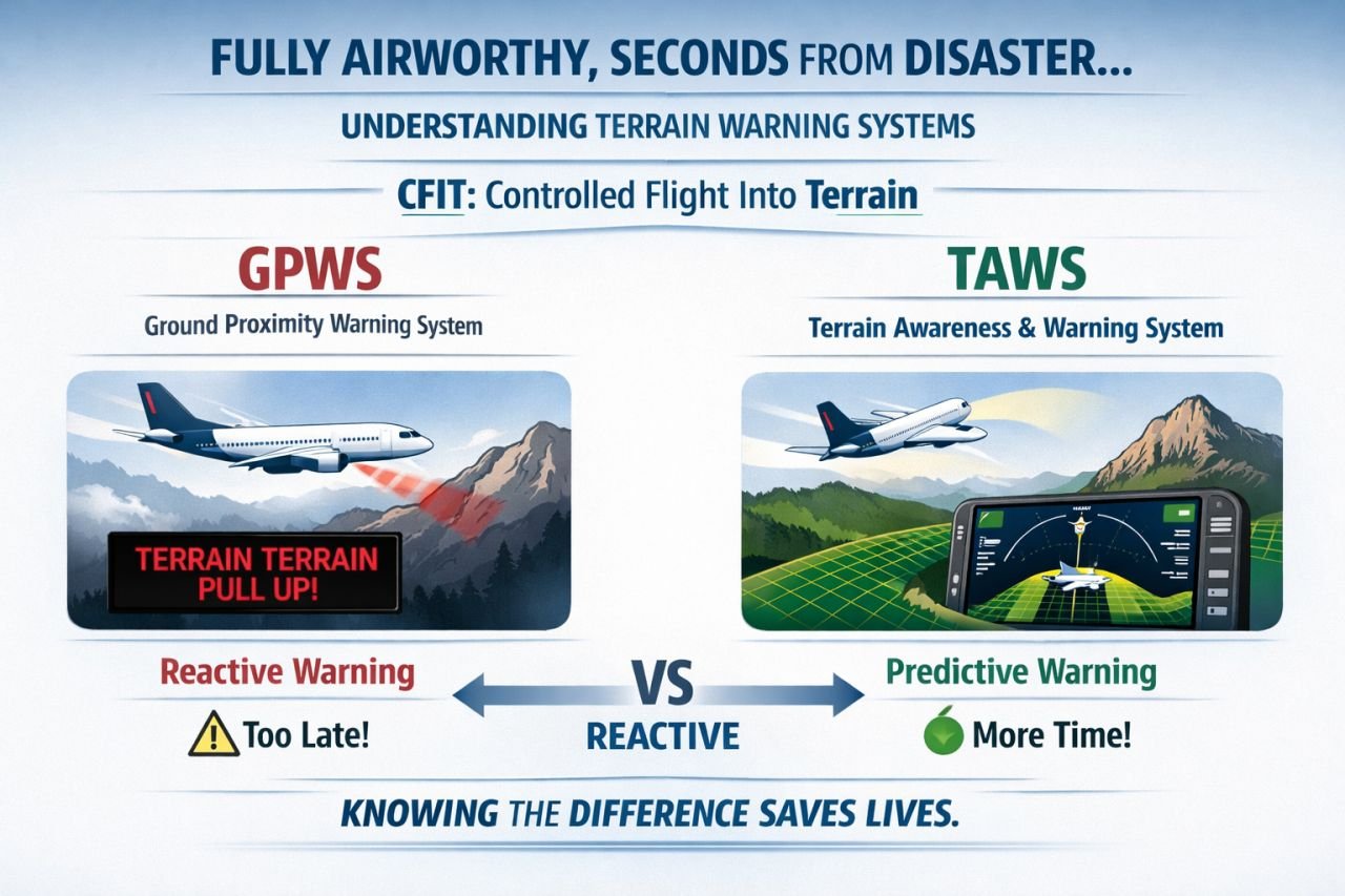
The Ground Proximity Warning System (GPWS) was a major safety step. It mainly uses the radio altimeter and aircraft parameters — descent rate, closure rate with the terrain below, configuration, glideslope deviation — to detect a dangerous situation. Its classic modes cover:
- Excessive descent rate
- Excessive terrain closure rate
- Altitude loss after take-off
- Unsafe terrain clearance when not in landing configuration
- Excessive deviation below the glideslope
The limitation is in the physics: a radio altimeter only looks down. If terrain rises steeply ahead, the warning may come very late — "TERRAIN, TERRAIN, PULL UP" with little time to respond.
TAWS: looking ahead
TAWS (Terrain Awareness and Warning System) — often called EGPWS — adds a terrain and obstacle database and the aircraft's position (usually from GNSS). With that, it can:
- look ahead along the flight path (forward-looking terrain avoidance),
- warn when the aircraft is too low for its distance from the runway (premature descent alert),
- show terrain on a display, colour-coded relative to the aircraft's altitude.
| GPWS | TAWS | |
|---|---|---|
| Main input | Radio altimeter, air data, configuration | All of GPWS plus position and a terrain/obstacle database |
| Looks | Down | Down and ahead |
| Character | Mainly reactive | More predictive |
| Typical result | A late, urgent warning | An earlier caution and more time to act |
Helicopters have their own version, HTAWS, with alert logic adapted to low-level rotorcraft operations.
Technology is the last barrier
TAWS has dramatically reduced CFIT, but it is the last line of defence. The first lines are still in the crew's hands:
- thorough approach briefings with terrain and minimum safe altitudes,
- stabilised approach criteria — and going around when they are not met,
- correct altimeter settings and cross-checks,
- an immediate, trained response to any terrain warning: no hesitation, no "let's see".
Check yourself
Knowledge check
Keep learning
Try the free course Human Factors Essentials for Pilots, or create an account to follow new articles.